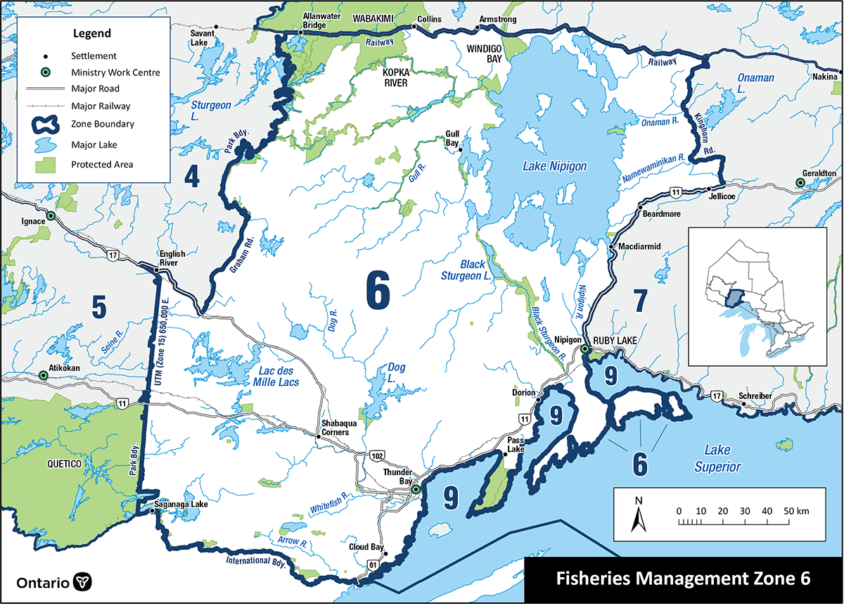
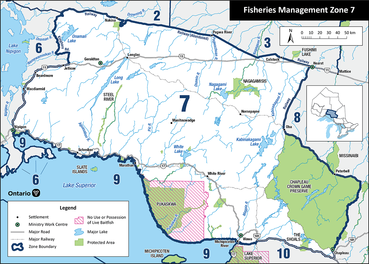
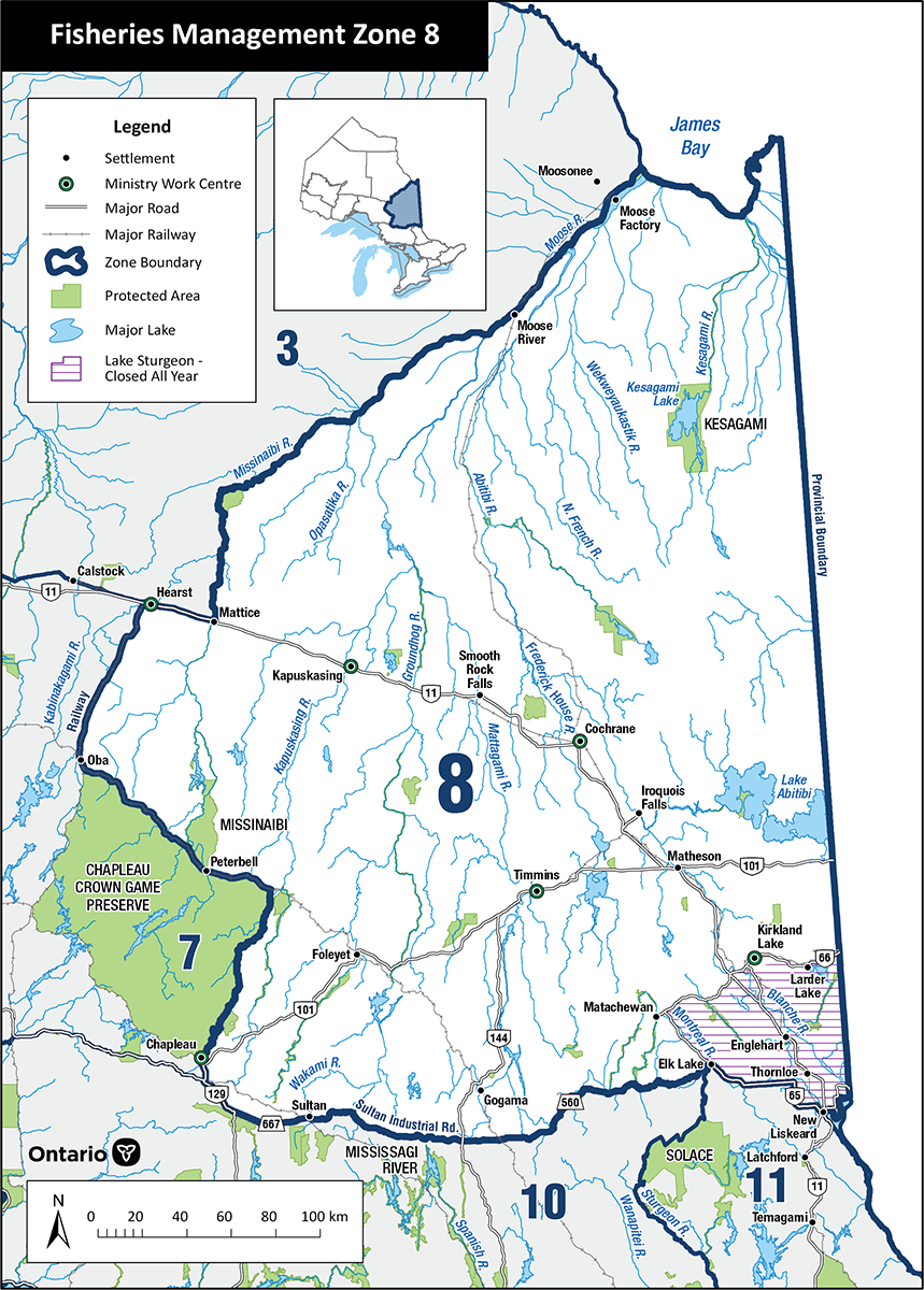
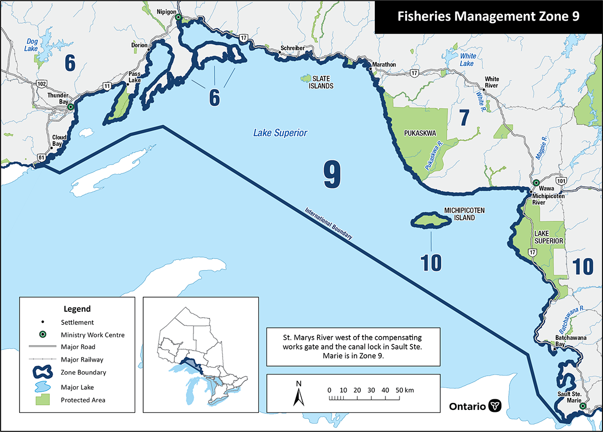
Ontario Fisheries Management Zone Map
Ontario is divided into 20 Fisheries Management Zones (FMZs). Each zone has its own seasons, catch limits, and special rules. Select a zone below to view its regulations, or use Fish ON-Line to find the zone for a specific lake or river.
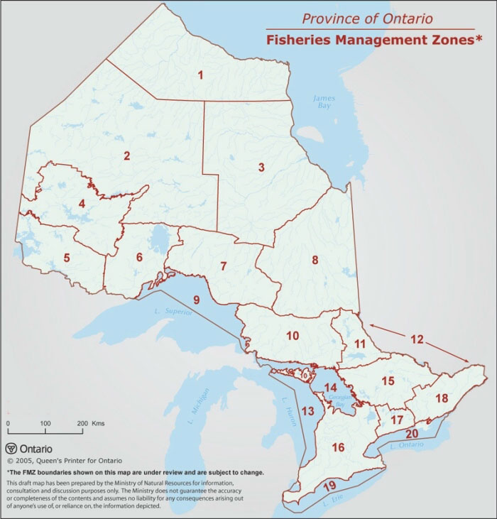
Source: Ontario Ministry of Natural Resources. View zone details at ontario.ca
Select a Zone
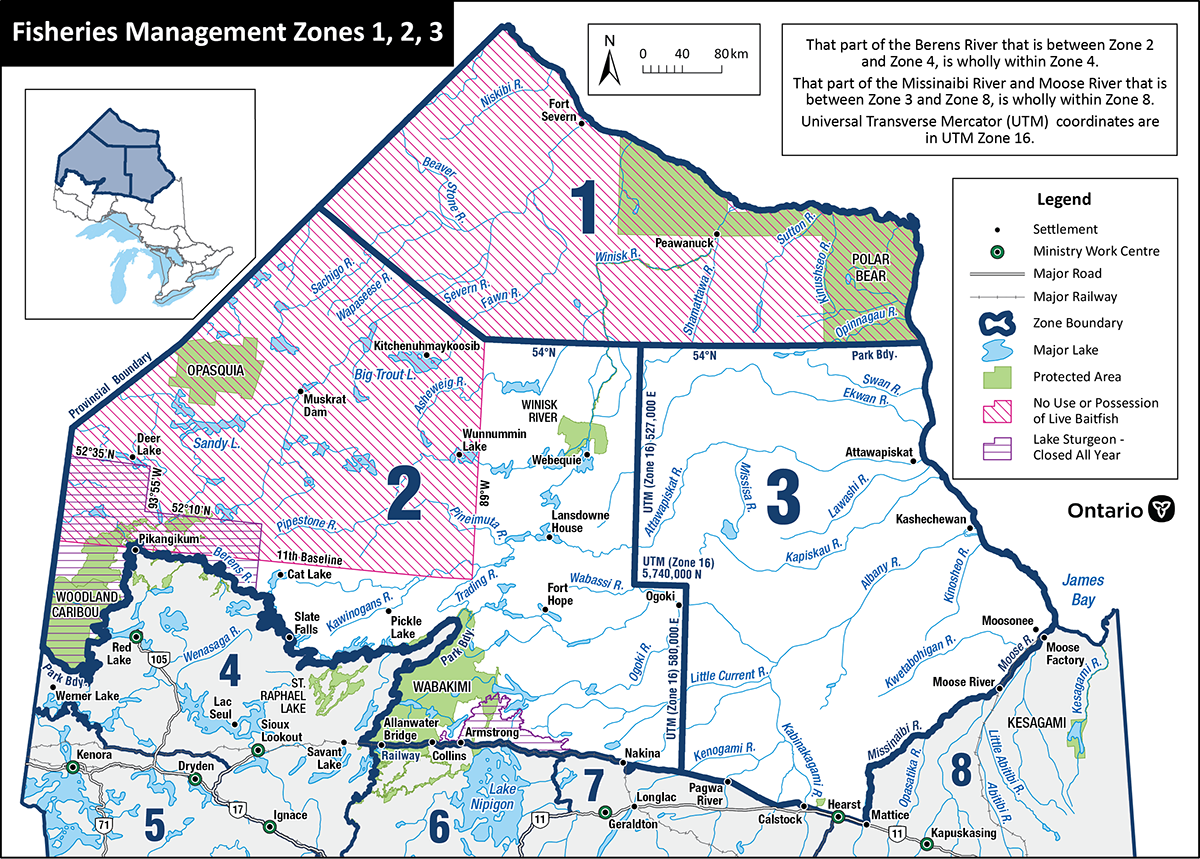
Far North (Peawanuck, Polar Bear Provincial Park)
Northeast Ontario - Far North
Far North West (Pickle Lake)
Northwest Ontario - Far North
Far North East (Attawapiskat, Kashechewan, Moosonee, Hearst)
Northeast Ontario - Far North
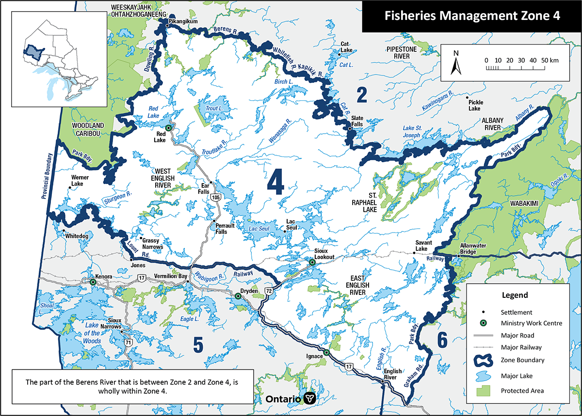
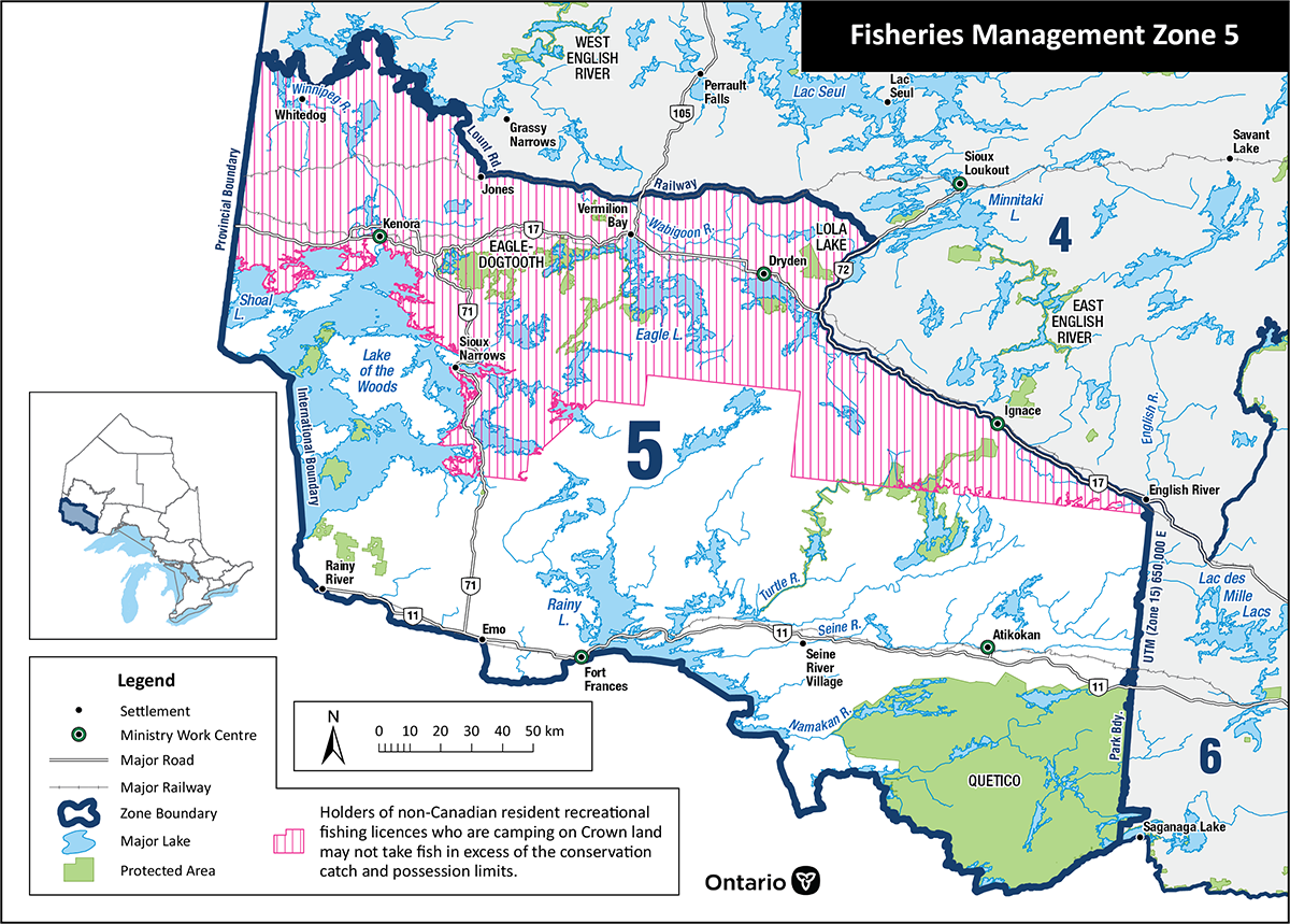
Kenora, Red Lake, Dryden, Sioux Lookout, Thunder Bay
Northwest Ontario
Fort Frances, Kenora, Dryden
Northwest Ontario
Thunder Bay, Nipigon, Dryden
Northwest Ontario
Geraldton, Terrace Bay, Manitouwadge, Wawa
Northwest / Northeast Ontario
Hearst, Chapleau, Cochrane, Timmins, Kirkland Lake
Northeast Ontario
Lake Superior
Great Lakes
Sault Ste. Marie and Sudbury
Northeast Ontario
North Bay, Temagami, Sturgeon Falls, New Liskeard
Northeast Ontario
Ottawa River
Northeast and Southern Ontario
Main Basin of Lake Huron
Great Lakes
Georgian Bay and the North Channel of Lake Huron
Great Lakes
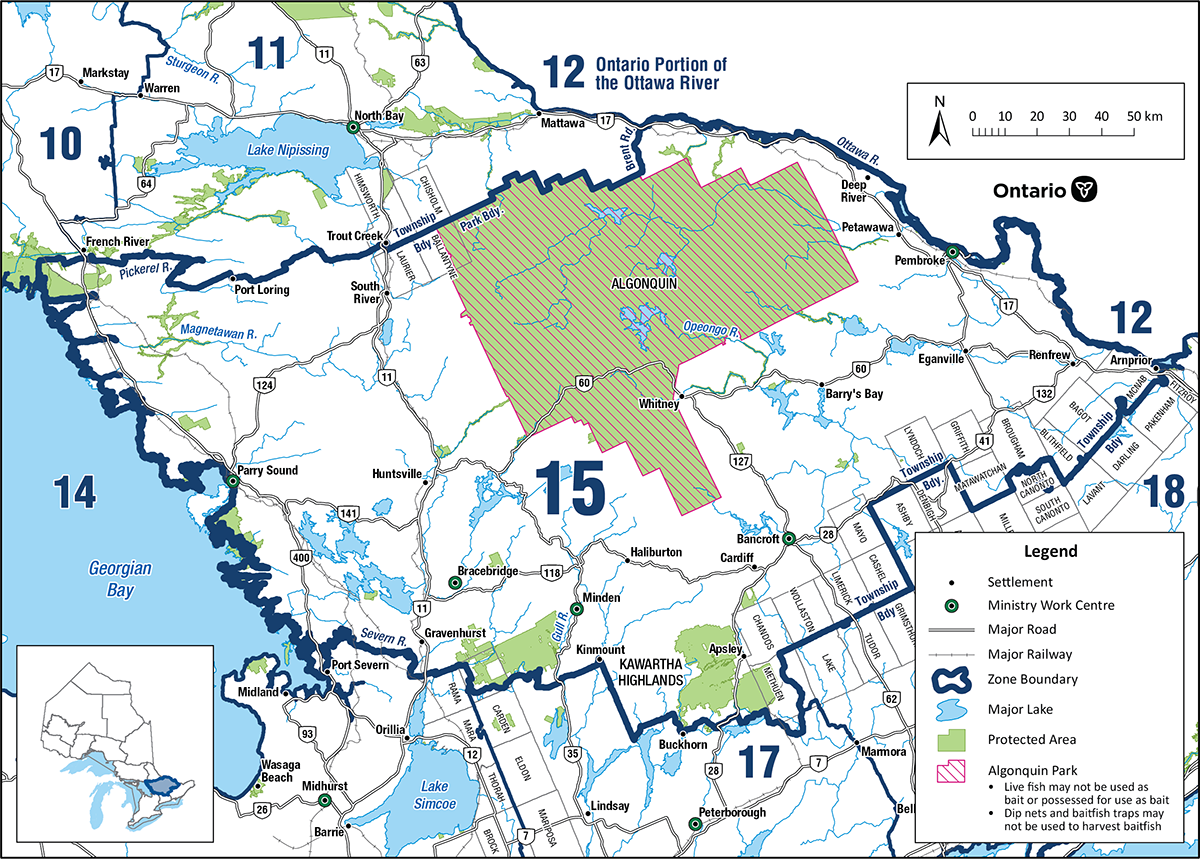
Parry Sound, Bancroft, Pembroke, Algonquin Park
Southern Ontario
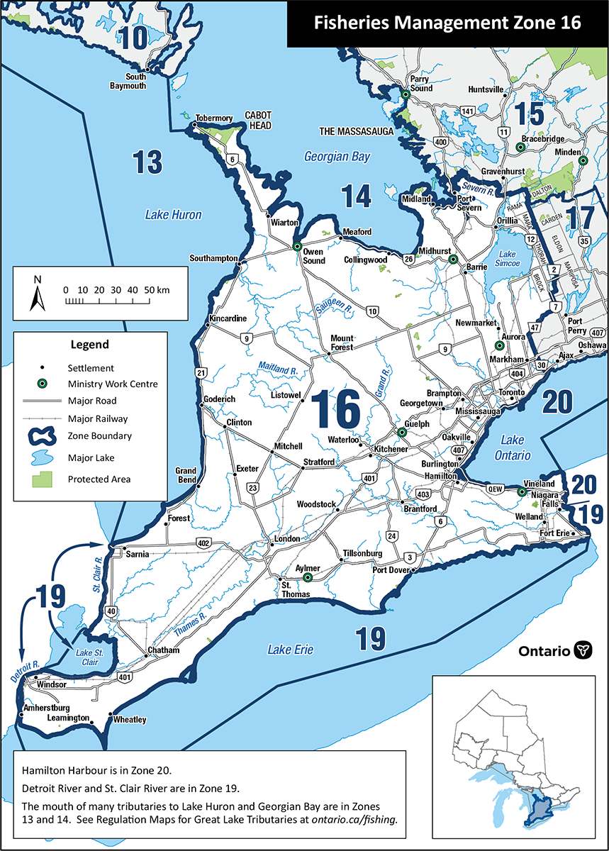
Southwestern Ontario and Lake Simcoe
Southern Ontario
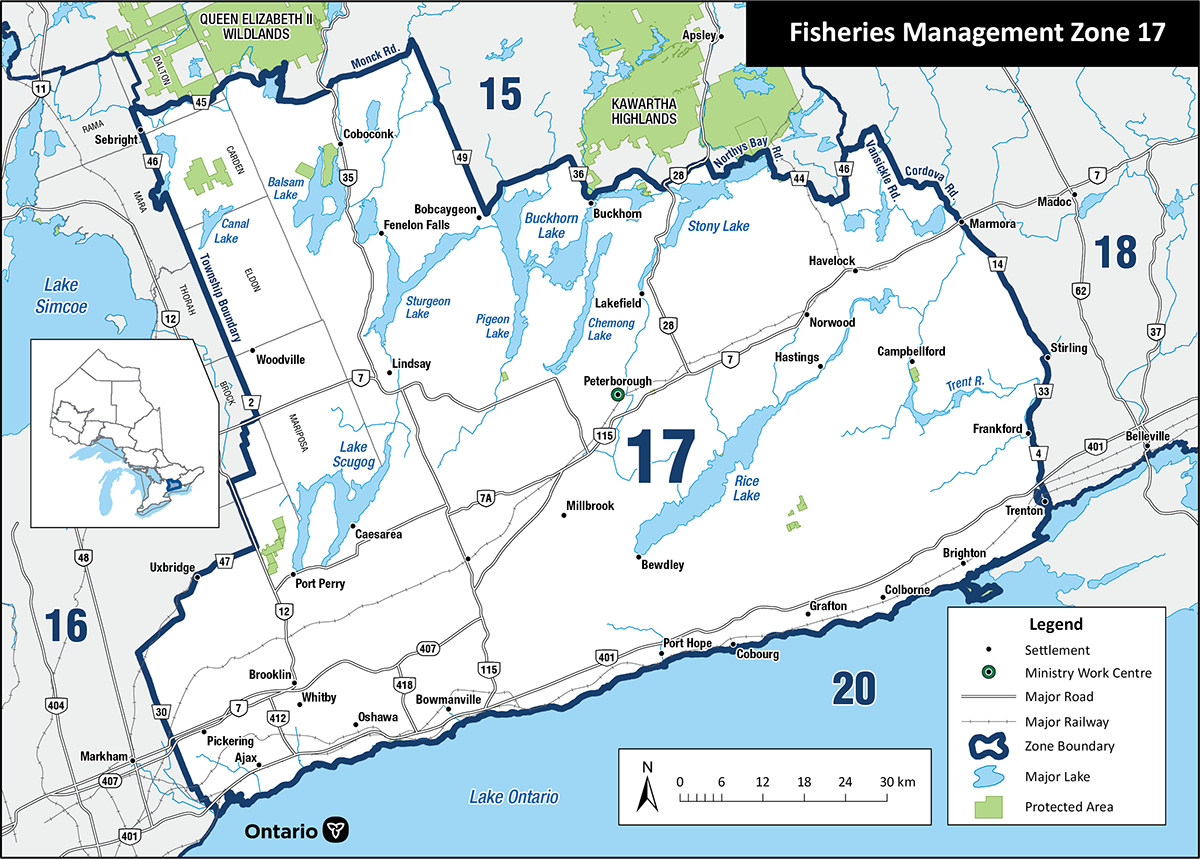
Peterborough and the Kawartha Lakes
Southern Ontario
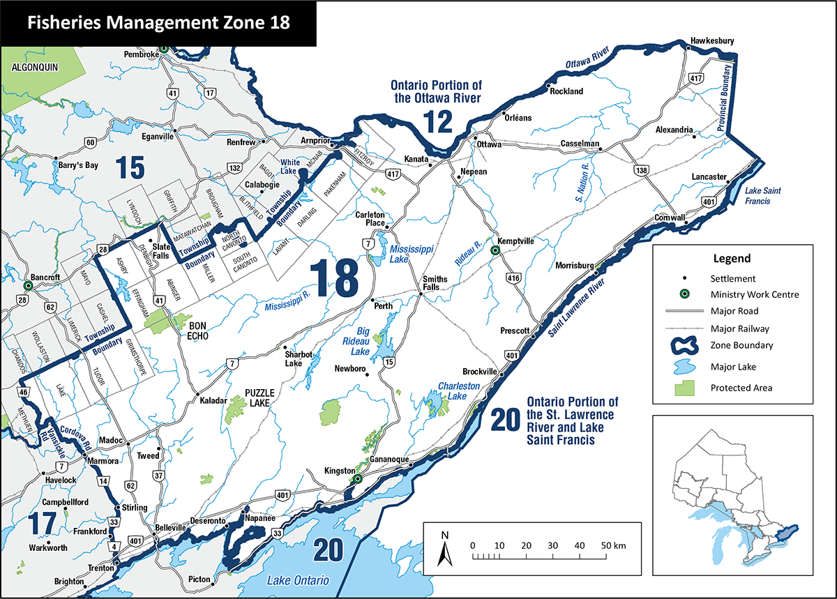
Eastern Ontario (Ottawa, Cornwall, Perth, Kingston, Belleville)
Southern Ontario
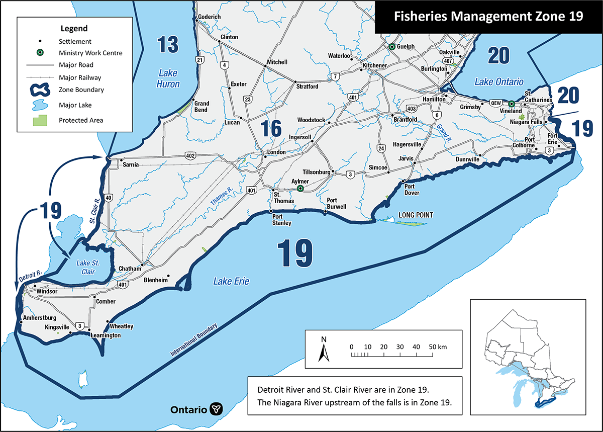
Lake Erie
Great Lakes
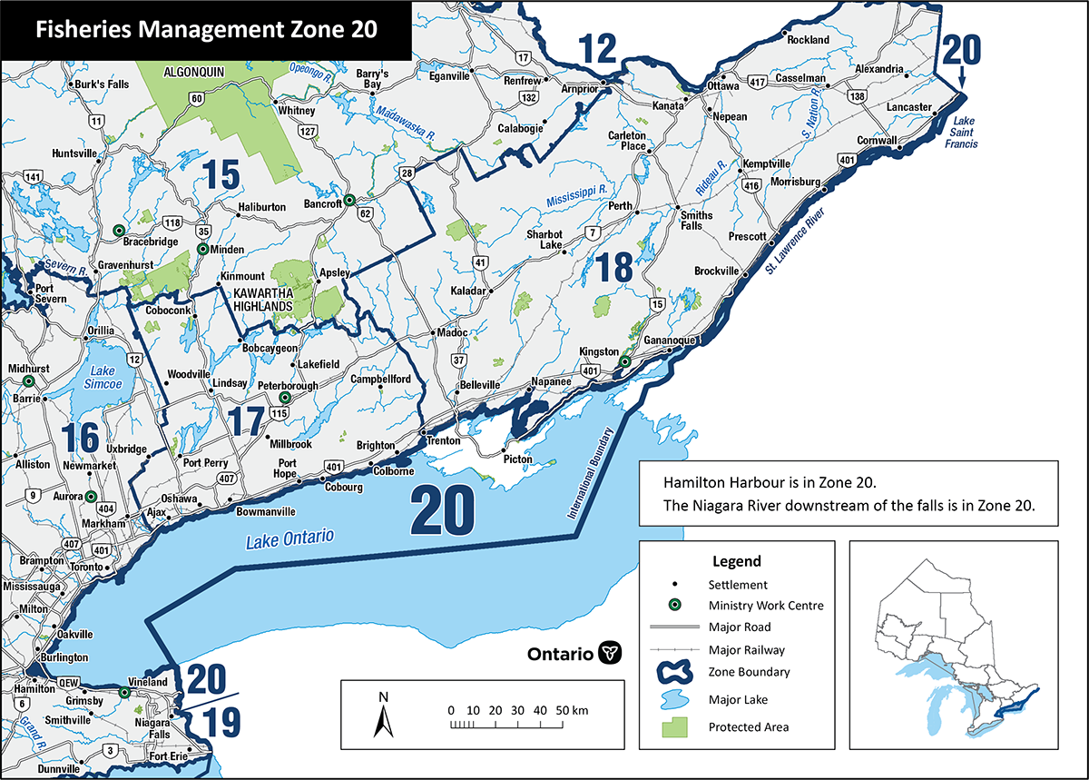
Lake Ontario (including Bay of Quinte, Niagara River, Hamilton Harbour, St. Lawrence River)
Great Lakes
Official Resources
2026 Fishing Regulations Summary
The full Ontario Fishing Regulations Summary with all zones, species exceptions, and waterbody exceptions.
Variation Orders
Variation orders amend Ontario fishery regulations. Check for the latest changes before your trip.
Fish ON-Line
Find your zone by lake or river, check regulations by location, and identify Ontario fish species.
Fishing Notices and Updates
New rules, regulation changes, and important notices for Ontario anglers.
Fishing Licences
Buy your Outdoors Card and fishing licence through the Ontario Fish and Wildlife Licensing Service.
Catch Limits and Size Rules
Detailed information on sport and conservation licence limits, size restrictions, and catch-and-release.